


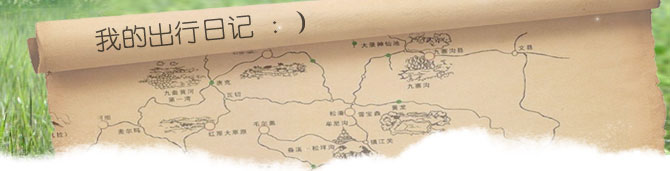
Brahmaputra Grand Canyon
Brahmaputra Grand Canyon region, mountains and little hills embrace Namjagbarwa, frozen snow and cold, it split the Tibetan Plateau and the Indian Ocean water vapor exchange of the mountain barrier, like a long wet tongue, to the high altitude water vapor transport within the stream, so that the Tibetan Plateau Southeast became the world's a green. Grand Canyon, the deepest reached 5382 meters, up to 496.3 kilometers, the river an average flow rate of 4425 cubic meters / second, with river flow of up to 16 m / s, fast-flowing, loss of water connected. The Grand Canyon is only 155 meters above sea level the lowest.
Brahmaputra Grand Canyon is the largest water vapor channels on the Tibetan Plateau by warm and humid air of the impact of ocean bream, the southern section of the Grand Canyon in decline fell up to 4000 millimeters, 1500-2000 mm in the northern section is also to help the region throughout the Grand Canyon, abnormal wet , covered with dense forests Yu, forming the world's most species-rich canyon.
Brahmaputra Grand Canyon of the most peculiar thing is that she Himalayan Mountains in the East End, from East and West, and serves only to go off a sudden the South, along the eastern Himalayas, south slope Duolu down, into the Indian Ocean, forming the world's most unusual horseshoe-shaped Daguai Wan.
Medog Medog is the Brahmaputra flows into India before the last one county of China's territory, but also in southeastern Tibet, one of the most remote counties across the country are inaccessible by road and the only one.
Brahmaputra Grand Canyon due to a poor environment, disaster-prone, constitute it difficult to cross the barriers and gaps, so that the plateau Medog into the "island" away from modern society's "Xanadu." Has even been outside pass as a mysterious land of Buddhists who have been referred to as "white corner of White Horse Gang", meaning "sacred lotus secret."
Namjagbarwa Namjagbarwa altitude of 7782 meters, is located inside the Grand Canyon Yajiang is the world's 15th summit. Barwa, in Tibetan means "fiery burning electric snow", plus one meaning "spear pierce straight into the sky." Mountain to the main gneiss. This mainly has three ridges, north-west ridge, northeast ridge and south ridge. Ridge about 30 km north-east winds, reaching as far shore arrived in the Brahmaputra ridge at an elevation of 7043 meters is PENG Feng, northwest ridge line highlights the altitude 6936 meters, 7146 meters peaks of the two soldier. Sloping walls of hard rocks exposed residues in the erosion of the ditch round after round of avalanche chute, into another valley full of huge glaciers.
Gallas white base peaks: 7234 meters above sea level, is located outside of the Grand Canyon Yajiang 95 degrees east longitude, and Nan Jiawa peak Across the river 20 km away from confrontation. Toward the east-west arc-shaped arrangement of mostly steep cliffs, the valley glaciers developed a number of 10. Its relatively flat top of the perennial snow-covered, steep terrain, avalanches are frequent.
Foot regional climate: hot and rainy the lower reaches of the Brahmaputra River, near the Pakistani Xi card annual rainfall of 4,000 millimeters and some areas up to 5000 mm or more, is one of the largest annual precipitation.
Best Walking time: early June to -10 in mid-month throughout the year to walk the Brahmaputra Grand Canyon of time. Later due to heavy snow in October, Medog will close off the mountains, until the following June and can not access to 8-September is the best time to drift Brahmaputra, 10 into the Medog the best season, this time leech and snake less, during the rainy season has just been completed.
Traveling:
Go to: Lhasa - Bayi Town, in the eastern suburbs of Lhasa bus terminal, take advantage of the town into a long-distance car, began to start every day 8:00 to 14:00 closed class, a group of 404 full miles per hour. Price per person: 80 (general CMB), 100 free (Deluxe CMB) for
Bayi Town --- Mainling - sent to the 81 rural towns should be subject to black-hearted after the car ride, bound Mainling car in the countryside, but the country sub-less, the fare for the 30 free. Get off, or on foot, or sent to the pine forest Heung mouth car rental prices more flexible, ranging from 10-100 yuan.
Back: Pai Long - Bayi Town, the town of Pai Lung to 81 more cars, the price of 50 yuan, and then can be further from the town of Black-81 to Lhasa.
Pai Dragon - Lhasa: Pai Lung fewer trips directly to Lhasa.
Bomi - Lhasa: Bomi to Lhasa train more, the price of 100-180 yuan
Accommodation: foot Medog, in addition to sending the Township, there are some simple Inn to stay outside, in the wild only in the deep canyon camp, half-way there are several points to stay in the black-hearted, but only bad.
Diet: In addition to rugby there are halal restaurants, the route in the Arnie Bridge, Khan, dense, up to a hole, baibung have the same people selling instant noodles, biscuits, canned food category, as well as providing cooking tools, location, Walker they can bring food to cook rice or convenience. As a long line of tough, capable of carrying some high-energy food supplements strength and amount of preparations for more rapid increase in blood oxygen content of the drugs, such as American ginseng.
Medog segment sent on foot to the village, is the main route into the Medog county every year in August to October is the cluster behavior in the golden season of county to transport materials, many are migrant workers out of this line.
(Note: this time into the canyon is also the best time) This section basically "there are roads and lines," a high safety factor. As for the intention to continue in-depth tour of the Grand Canyon are concerned, this paragraph can check your itinerary, perseverance and adaptability. The most classic line of this article, but the climate is also up to change a complex road conditions, route length, so the non-ordinary traveler could easily qualified. Route length of 320 km, in the climate, traffic, health, access checks and other factors are smooth case, time-consuming and also need to walk 14-16 days, but are often delayed because of various reasons a few days or even 10 days trip .
This line in the Khan dense baibung, Medog, heating Sa, Gan Deng few places will check the border passes and identity card, if there is no evidence of relevant units, letter of introduction, some sections are prohibited viable. On the whole, this line features prominent, covering the Grand Canyon region the situation. One of the most important thing is to enter into the Medog and za qu in two places, one is the only county inaccessible by road, one is watching magic "Yaruzampbo Daguai Wan," the Holy Land. Trip which, in crossing the mountains, can have multiple male pull of "The mountain sub-Four Seasons" of different natural landscape diversity. Expedition route on foot after all the King of Kings.
Specific itinerary route A: sent Township - Pine I - more than neighboring Butler - Khan density - baibung - Medog-113K-118K next to the XIN - za qu - Pai Lung first day: sent Township - Pine I walk 18 km Description: Since the township started sending journey through the Grand Canyon, the towering mountains towering over neighboring scenery will pull people memorable.
Gangga Bridge, along the Brahmaputra to reach the camp Mainling Township, from a simple mountain road 18 kilometers north, they arrive at a place called Pine mouth, here is the final car to reach the place, from a real sense began to Medog forward journey on foot. Sent to the Township is Linzhi Medog county in the black-hearted stop delivery of supplies, the army is also the transit of goods. There are many here, like "barracks" have the same arrangement of wooden houses, is out of the material transactions Medog distributing center in each of the transport season, hit a monk doing on the 1st day of bell crowded. You can do here the last one before entering Medog procurement, such as: leg wrappings, cigarettes, canned food, fortified biscuits, instant noodles and so on. Migrant workers (porter) is also required to hire here, the general price of 10-20 yuan. There are several shops and halal restaurant for Sichuan food, mediated higher prices.
(Hint: send Township to the mouth of Pine Hill Road, drive, transport trucks often this season, you can discuss travel or special delivery, while walking up the hill about 3 hours, it may spend money traveling this lonely journey, to go day, God Bell hit one day be able to climb over the next day over the season, neighboring Butler Transport will "deserted" a)
The next day: pine mouth - Multi-hung La Pass - 20 km walk from Rugby Introduction: climb over the course of male la very difficult, not only to adapt to high altitude physiological responses, as well as snowstorms, the harsh environment of uncertainty.
More than 1000 meters above sea level has been more than 4000 meters above sea level on the multi-male pull mountain, snow and ice from the cold world of hot and humid sub-tropical jungle to the peak of the fir tree in the jungle of the wild banana. Can see a clear vertical distribution of different natural zones.
Multi-hung La Pass 4221 meters above sea level, on a steep mountain, but it is not difficult to walk, mostly for large stone paved road, about 3 hours to reach Yamaguchi, Yamaguchi had the wind horse flag fluttered Mani Dui (hint: Yamaguchi colder, cold to wear warm clothing in advance, in fact, that is, thick clothes come in handy on this day, after almost irrelevant.) the need to pay attention to selecting the right time to climb over neighboring pull mountain, but also necessary in the climbed over a pass before one o'clock at noon, as the afternoon easy to weather changes, the Peak will be heavy fog filled the air, and even snowstorms, easy to lose direction and dangerous.
Way under the mountain streams, mostly in summer melting of snow water will come down the road to go even worse, some more than two hours can be to the Da Lage (Note: The lag is composed of several simple wooden shed reception center for the exchange The provision of accommodation, the general accommodation of 10 yuan. also sells biscuits, instant noodles and other foods.)
The third day of rugby - Hole in the Rock - a small cave - 30 km walk from Khan density profile: a difficult road trip in the mountain continues, leech who became a peer, long-range raid border checkpoints to reach the minimum.
The day's itinerary hard, hard road to go, all the stones in the jungle is undecided, about 1-2 meters wide and slippery after the rain will be even more difficult to use. (Hint: Do not pay attention to maintaining balance between the body wei feet, it is best to find a walking stick made of bamboo or tree branches.).
When approaching secret Khan (Khan density is also a reception center) into a leech area (hint: pay attention to wet weather, leech more active, if it is sunny, you need not worry about). Khan secret military depot only three individuals, two soldiers, a platoon leader (Note: said to be the smallest army depot), the depot there generators, TV.
Day Four: Khan Mi - Lao Huzui - Ani bridge walk 15 kilometers Introduction Introduction; to go narrow, steep mountain gone, as in the tiger-like intermediate risk of moving in and out, this is full of the most difficult places.
Travel distance is relatively insignificant, generally walk about 5 hours to complete. Some sections of narrow, some of the tiger on the front and rear intermediate downhill, although there are no major climbs, but still consume the spirit and energy.
Intermediate is a tiger in the rock dug out of the road, in order to steep canyon terrain, more waterfalls. Began its narrow, highly dangerous, it is a multi-male La Hill to Medog the most dangerous section of road. But the local people against the road has been widened a bit, the relative risk have also been reduced, but in any case when the concentration of this road through the spirit of caution. Guo Lao Huzui more muddy road after about 2 hours can be the bridge to Ani. Bridge has two Palestinians opened the door a simple reception center, wood shop Chase, accommodation 10 yuan / person, alcoholic drinks and tobacco, beverages, food for sale. If the door Palestinian people are not accustomed to eating rice, it is best to pay a little hot money, firewood fees, processing fees, and cook their own food to eat. Ani bridge scenery good, clear water under the bridge Pentium roar, you can stay in this multi-day, leisurely break.
Day Five: Arnie Bridge - Erhaoqiao - Magnon - Jiefang Bridge - baibung About 23 km walk: along the river road is a difficult journey, waiting for you is endless climbing.
After the bridge over Erhaoqiao from Arnie is a poor junctions, where there is another one that is hesitant to go to Medog Dexing, hesitating to go baibung relative to Medog last few, very bad to go (hint: is not an option via baibung line, although some bypass, but a good one.)
Along the multi-male song to the liberation of the bridge, the bridge there are bunkers, checkpoints, border stations. And then move forward with the Department of stationing troops there (hint: the liberation when the bridge must be closed against photographers clamor up, here is a military powerhouse strictly forbidden. Even the Bridge River views are not taken, the machine incorporated into the bag, do not take In the hands of soldiers guarding it from the inventory, and even exposure Tiao film.)
After climbing the bridge is a piece of border roads, township government hospital baibung honor at its highest point, Medog County's only secondary school is also located here. At night, living in the township government guest house, 10-20 yuan / day, small shops have instant noodles, canned food, beer, drinks, etc. for sale (hint: along the way has already begun to enter the door Pakistan, Lhoba ethnic minority populated areas, because people are under the old drug history, be careful not to drink lightly in the local farming season, usually in a toast to you when the poison.
On the sixth day: baibung - Asia so - Medog 30 km walk
Introduction: the arrival of Lotus in full bloom Kunimatsu place, here is the peak of faith, as well as stubbornly high prices.
Road conditions good, the whole stupid route be regarded as "highway" of the entire process is a gentle way between books. Medog is located in the Brahmaputra side of a platform on top of the hill is not high, was the land, surrounded by trees and surrounded by mist-shrouded, reminding us of scenes paradise on earth.
Medog can stay in guest houses in the county (county hospital), accommodation 20 yuan / day. County, there are two Sichuanese restaurant opened, but the price is high. Because the county where the goods have to rely on human and draft animals transported from the outside in. "scarcity value." Medog have Eqin friend Temple, went to the temple takes about 4 hours or so, is a very steep uphill undecided, and the leech are many and large (Note: Eqin friend Temple, is the largest and most famous temple Medog is located in Medog Village Zema La Mountain, about 300 years of history. In 1950 had destroyed in a fire, now the reconstruction of the temple, the main building of stone and wood three-tiered structure, open East and West 4, Zhu Gong Buddhist master Padmasambhava.)
Seventh day: Medog-113K108K walk 32 kilometers Description: Today, faced with falling rock, landslides, and only traces of the past walked the road, hesitating long and dangerous.
This is a thrilling stoppage of tough to go through a lot of landslide areas, adoption should be careful to observe the overhead of the falling rock. 113K is about 2-3 km in the vicinity of the landslide area, many large and there is a regular shaped stones, under the honorary title (hint: pay attention to avoid the bump injuries), part of the circuit of the local multi-with large logs take hesitating, as long as the Rotary steady speed through the Discovery can.
In the 108K there are two paths to choose from, route A to a row of long, route B to Bomi.
Route A: to a row of dragon
108K-eighth day of walking 32 kilometers beside the Sim Description: This day is a long walk, the park continued to be freed next Sim.
Is a non-stop uphill all the way down the mountain, but the road is better, but the road there are wild fruit to eat, there are spring thirst-quenching, which for those on foot is not physically in terms of spirit is a good supplement. In the next to the XIN can properly adjust the number (Note: 4 is the famous Medog Ishinabe three country of origin, the locals will be Ishinabe material known as "soap stone", an easily formed rock carving), at night, places on the Township Guest House, 15 yuan / person, no electricity, buying candles 2 yuan / root. Only the next to the XIN Township Township office can generate electricity with diesel engines, there are several rows of wooden chairs, you can watch TV.
Ninth day: next to the XIN - complaints Yung Village - heating Sa - Gan Deng Description: under the influence of geological activity, generating a number of difficult and dangerous juncture, landslides, debris flows is very difficult to walk.
This section is not up and down the mountain and the high mountains and steep slope. In addition, the geological section of this hesitant activities between the many mountain rivers, resulting in a lot of landslides, debris flow landslide area, walking up and very difficult, the best local guides please bring undecided. Gan Deng before approaching a leech areas, narrow roads and high grass.
They pass through the village can be a short break in case of capacity. Sa, Gan Deng has a rural guest houses can accommodate accommodation, usually 10-20 yuan / day (Hint: Gan Deng is undecided on this Medog County, the last village, where the border to accept cards, identity cards and checks. ).
10th - 15 days: Gan Tang - Clarie - Guo Brad Hill - 8 Tamamura - za qu walk 60 km Description: up to 5 days of walking, traffic complexity will inevitably have to encounter leech worm, Along with old doors for Palestinian small village to rest Yajiang stunning wonders of the Grand Canyon on their way.
Than 2 Ying Hengrou slide across the Grand Canyon: Lu Gan Deng to the ancient village of the eight-yu za qu. This section is complex and dangerous road conditions, you can see many waterfalls along the gorge base and turning, the normal time to go down and take about 5 days. One Guo Brad Hill 3,000 meters above sea level about humilis profusion, there are caves and abandoned huts could stay at rest. Road along the mountain stream to go down very piebald, which few paragraphs along the river road, river bank due to the formation of a number of landslides on steep slopes extend to the riverside, are gravel and sand, simply can not stand firm. Some sections simply a blind alley and need to open the trip guides.
Lu ancient village gate to save the Palestinian National customs are more, especially in reproductive worship, hunting, etc. practices. 8 Yu villagers, most of the Grand Canyon have been moved, leaving several families.
Za qu is a large village, located in Mao cloth Yalu River Judging from the junction of Long zangbo River, where can watch Ya River and Pago River 2 twins like "horseshoe" Da Guaiwan.
16th - 18 days: za qu - Yu-Mei - Pai Long walk 35 kilometers Description: walk Parhong zangbo River, from the restricted area of life out of the end of this extreme journey. It normally takes 2-3 days trip, multi-zone there are landslides, from za qu out of the village along the river road Parhong zangbo. Through two Liusuo, if you want to bypass a large landslide area, it is necessary another 2 Liusuo.
Pai Lung has a street on each side of a row of huts, there are restaurants and small hotels to provide accommodation (Note: The Department can nearby hot spring areas.
Route B: This way is a waste of money to build the country that year a wave Mexican highway, to help in many places named by the number of kilometers, such as "80K", mother of 80 kilometers.
Eighth day: 108K-80K
Description: landslides across the landslide area, is a physical test of will.
Along the river road Ga Ryuzo cloth, is the most difficult period hesitant to go and most thrilling and dangerous section of the mountain landslides, mud-rock flow, landslide areas, road damage is very serious. To 80K is about 1 hour ago on a trip mountain, mountain streams often take the body wet (Note: 100K at a village, you can board and lodging).
The ninth day: 80K-52K-ga Long, sa (24K) - tie wood - Bomi Introduction: climb Ga Long pull mountains, experience the ancient wisdom of Tibetan villages, to reach the abandoned Bomi, the end of the journey.
As the road stretches on relatively intact, on foot with relative ease (hint: an elevation of 4,700 meters, crossing the La Ga Lung extremely steep mountain undecided, terrified, we must be careful). From the beginning, you can take a truck 80K to Bomi had.
80K Department has the village, is a black-hearted Yun Ah, a small shop selling, room and board points, Lu Xiangting, accommodation, 10 yuan / day (Note: the road from Bomi to enter Medog or end here)). From August to November each year to go to this hesitating between a truck delivering supplies, if you can take this time out of Medog to the bandwagon.
Ga Long, sa 6,7 more than a month of rain and snow, and the elevation, the temperature decreased (Hint: need to open the line of guides should be prepared in advance cold clothing). Foot of the mountain with the honorary title of the village, and Ga-lung Temple, the temple dedicated to Padmasambhava's fingerprint, there are several monks care of the temple, the temple next to a tall white streamer Piaoman hidden cemetery dirt.
Bomi is located in the Brahmaputra east coast, due to the Sichuan-Tibet Highway tie to wear wooden town, here to become traffic town. The Sichuan-Tibet line bad natural disasters, but also to make this area was isolated, where the ancient ruins of Bomi dynasty, there is the nation's largest Caccin glacier. Classified on the end to reach the thrilling hiking.
Travel Equipment Shoes: Because thanks to their feet in the Grand Canyon in the road on foot, a pair of proper shoes to protect your feet and have a very important role in the smooth passage. What kind of shoes, but chose not to leg muscles according to their personal circumstances, choose any season to enter the Grand Canyon, and different conditions may be undecided. Waterproof professional jaw mountain shoes, shoes slander thick, with excellent anti-slip, protective role of ankle foot, another a certain role in the protection and help. However, more should be involved in the Grand Canyon river and off the water entering into the shoe but can not get out, but not easy to dry after the wet shoes through the mud and debris flow location, the mount will become thick mud after the very Shen .
Army shoes with a light, sensitive and inexpensive and so on. Both Genjiao and easy to water, easy to dry after the wet. Its advantage over landslide zone is particularly evident, you can "such as touching," jump in the size of the stone Jue on the fast track approval. However, because of their thin soles, walk in a mountain road covered with gravel, often they will slightly Da Sheng Teng feet, and even swollen feet away.
Slippers is used to walking a day after the road is difficult, when you reach the short-tailed bird to wear, to their feet, relax, contact the fresh air and threw himself to relax.
Of course, if climbing shoes, military shoes, slippers, each with a pair of the perfect, and may be something back of course, also increased the weight.
Waterproof backpack, waterproof Jackets:
Grand Canyon, mostly hot and humid and rainy climate, back waterproof bag with a waterproof cover needed can save a lot of trouble can be avoided with the bag damp or wet items.
Jackets waterproof windproof role, can protect the body from being wet when it rains, while too high altitude and cold Yamaguchi effect when there is warm, eliminating the cycle of warm clothing Chuanyu Yi or add trouble.
Gaiter is essential items. For the anti-leech has a significant role, but also can play the role of fixed and protect the ankle.
Other clothing: do not bring too many thick clothes, with a fleece or sweater is sufficient. Shorts, socks and underwear number (because walking can laundry indefinite period, it is best to prepare some more convenient to replace.
Other options items:
Global positioning system, high-powered binoculars, field stoves, tents, sleeping bags, moisture-proof pad, boat, poncho, water bottle, flashlight, sunglasses, sunscreen, toiletries, camera, film, notebook (waterproof bag to prevent moisture load).
Drugs: If you intend to stay longer the Grand Canyon, then, be sure to bring enough medicine, because the journey there is no place to supply basic medicines, but also to prepare more specific drugs, such as "Jidesheng" Yi Yao, its drug-feng The bite wounds, more preparation more Band-Aid, gauze, sterile drugs (such as alcohol cotton, Yunnanbaiyao), etc.; due to hot and humid climate and mosquito bites, who often intolerable itching in preparation for some cool oil, Essential Balm, Shuang-chi weeks all things pink.
Da more things to prepare and then the whole, not as good as ready to lay down their own, with a good physical, mental state and ability to adapt to the harsh environment to enter the Grand Canyon is the most critical.
Trip in the environment, climate, undecided status of right to participate in the quality of player requirements and related note:
Please carefully to judge their own physical and psychological endurance, ability to perform mountain trek. Bid farewell to specify: the way to climb a few more than 3,000 meters above sea level pass, after many landslides on steep slopes, Suidan Po, jungle, muddy, slippery sections, must be very difficult, only the psychological well-prepared people to be competent.
With unity and cooperation, mutual aid fraternal teamwork, tenacity and confidence.
Our environment, in the camps and during the march is not littering with self-regulatory capacity for civil conduct.
After the mountain of fire, do not look at King hesitant to go to see King did not walk.
Therefore, the particularity of the region, accommodation must be hard, there is no meat, but also fill ribbons lack of almost all food by human back into, it must be well prepared when the luggage items accurately, in order to put an additional burden to a minimum.
To have the basic bottom-up knowledge and experience in the field, the main contents include: orienteering, mountain climbing, river-related, first-aid (to the timely processing of a variety of common diseases and injuries). Institute of figuring edible plants, such as fungus, strawberries, bamboo dishes, wild lemon, mushroom and so on. Society of the Grand Canyon wildlife protection: dry leech, ticks, snakes, wasps, snakes and so on.
Author: West Tourism Forum From: Western Tourism Forum Login name: Shanghai Prodigal Son